Hiking in Mount Rainier National Park

Standing at an impressive height of 14,410 feet, Mount Rainier is the tallest mountain in Washington State, providing a dramatic backdrop over Puget Sound. Classified as a stratovolcano (a conical-shaped volcano built up over many years by a variety of magma types), its last eruption was in 1450, although many small unconfirmed eruptions were reported in the 1800s. There are 25 major glaciers on Mount Rainier, supporting 5 major river systems and representing the largest single-mountain glacial system within the contiguous United States. Its stunning beauty is observed in glacier-capped summits, ancient forests of coniferous trees lining its lower slopes, subalpine meadows blanketed in wildflowers, turquoise-blue lakes and waterfalls, and a plethora of wildlife across the mountain’s many ecosystems.
We made sure to download our trail maps ahead of time through AllTrails. Given that it was mid-June, we were expecting snow at the higher elevation and planned accordingly, wearing layers, microspikes, and SUNSCREEN! We were lucky enough to be able to rent microspikes through Whittaker Mountaineering in Ashford for $12/day. The Rainier Base Camp Bar & Grill is located next door, with amazing pizza, live music, and stunning mountain views. Worth a stop after a long day of hiking! This is also a major hub for guided mountaineering expeditions.
Ohanapecosh Hot Springs & Silver Falls Loop- Mount Rainier National Park
Difficulty: Easy/Moderate. Distance: 2.9 miles. Elevation gain: 521 ft. Time: 1.5 hours. Trailhead: Ohanapecosh campground.
We hiked this trail our first night after a long day of travel and found it to be the perfect start to our adventure. Minimal effort with high rewards.
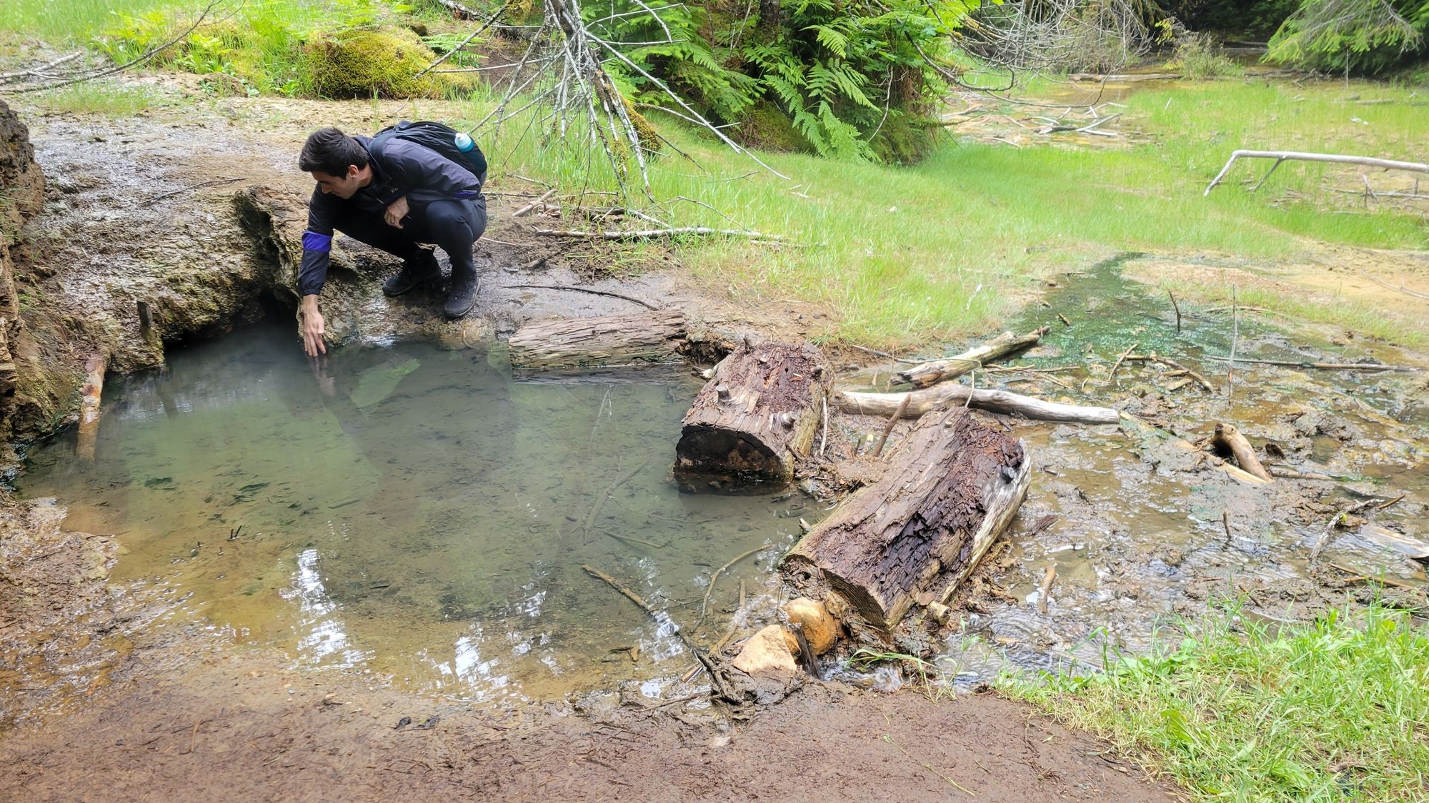
The hot springs themselves are underwhelming and are more of a trickle amongst the rocks with some sulfurous puddles. However, it’s still a neat pit stop to make along the more impressive Silver Falls trail. Although you can’t soak in them, you can still take a feel of the warm waters once thought to contain healing properties.
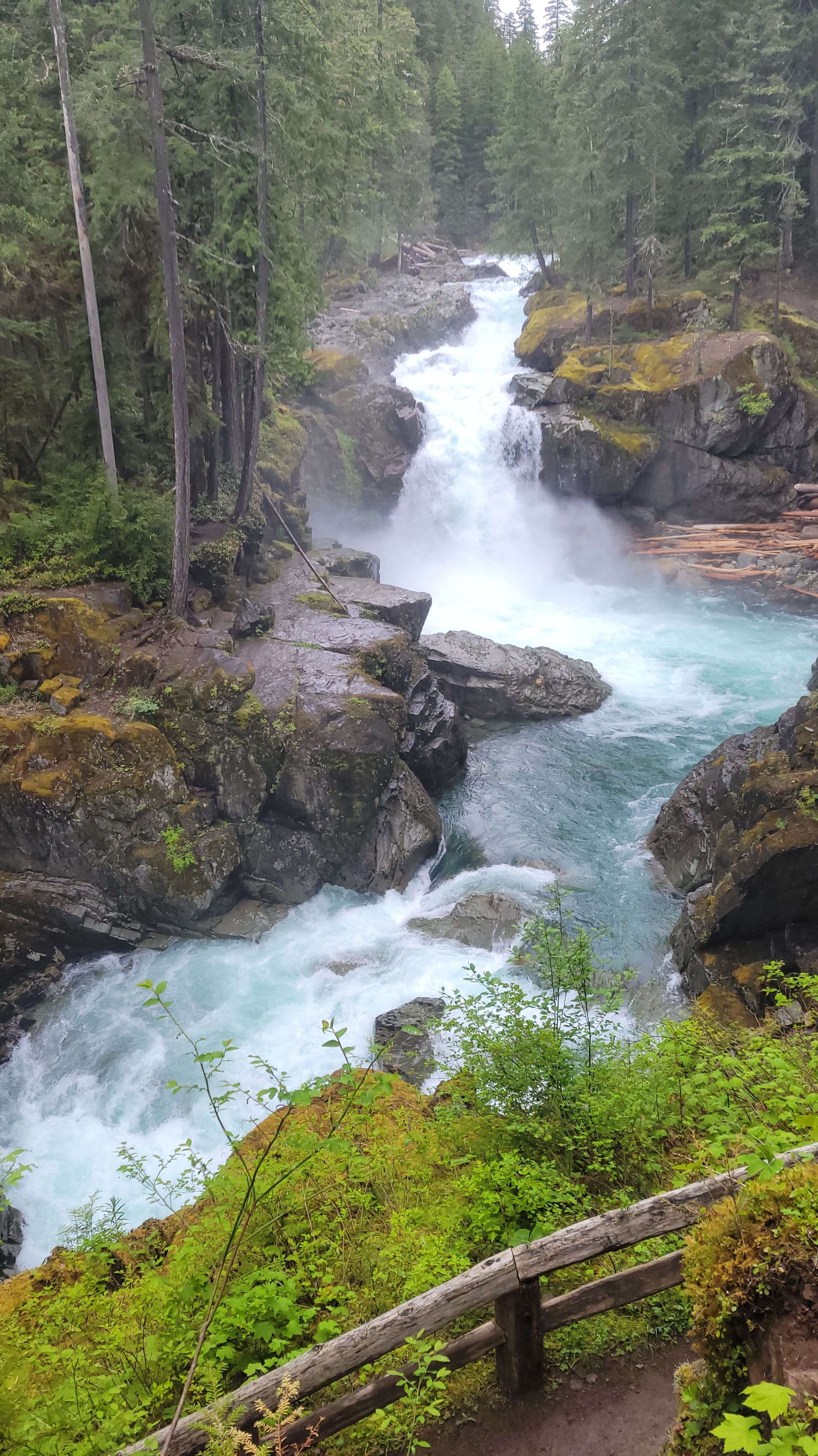
Continue along the trail by listening to the rush of the Ohanapecosh River. Hiking the loop counterclockwise will provide the best views in the first half, taking you up a steady climb through an ancient forest, across multiple log bridges, and past several waterfalls.
The impressive views of Silver Falls are seen at multiple viewpoints as the trail switchbacks down to the bridge which crosses the river. This was also our first taste of the incredible turquoise-blue waters of the Pacific Northwest.
After crossing over the river, the trail loops back around through old-growth forest before ending at the Ohanapecosh campground amphitheater.
Overall, we found this to be a beautiful family-friendly hike with magnificent waterfall views. This was one of the best waterfalls we saw on our entire trip and is well worth a stop if you’re in the area.
Skyline Trail Loop - Mount Rainier National Park
Difficulty: Moderate. Distance: 5.6 miles. Elevation gain: 1,771 ft. Time: 3-4.5 hours. Trailhead: Jackson Visitors Center in Paradise.
When we visited in mid-June, the trail was still almost entirely covered in snow, and we did manage to lose the trail in a few spots before managing to find our way back to it. Microspikes were helpful but not an absolute necessity. We decided to hike this trail clockwise, but it’s certain to inspire awe from either direction.
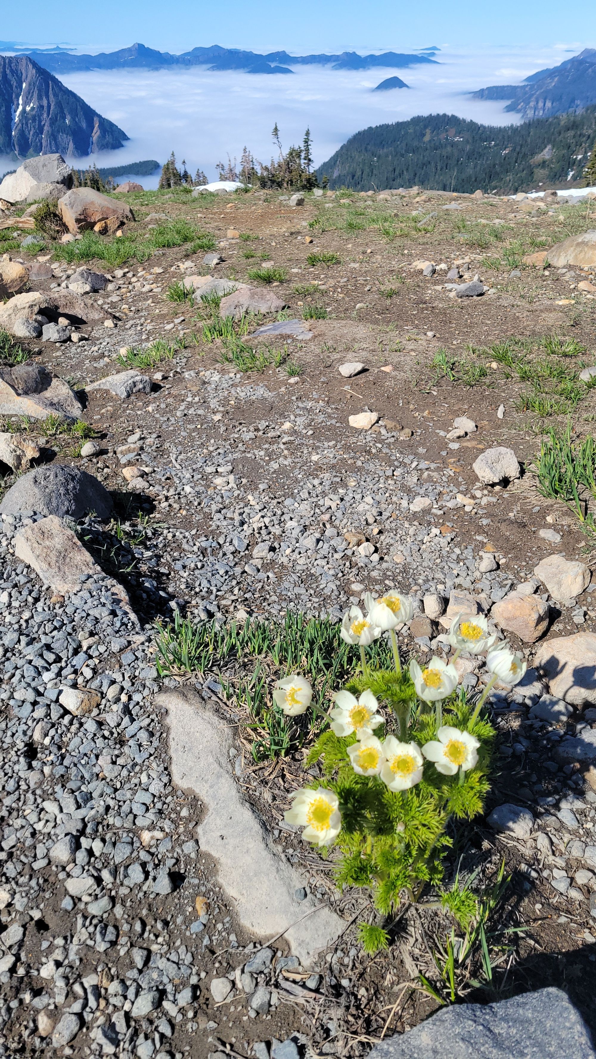
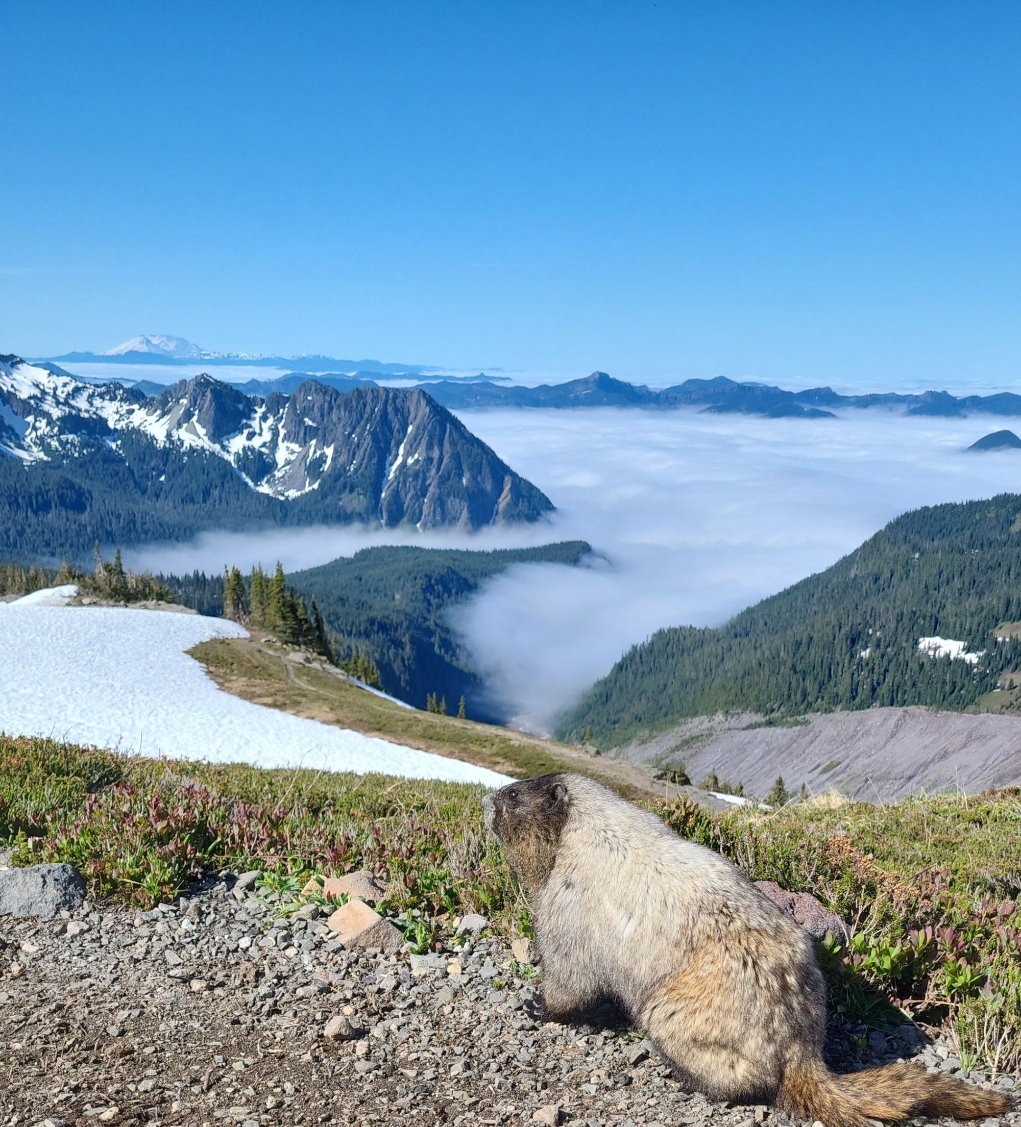
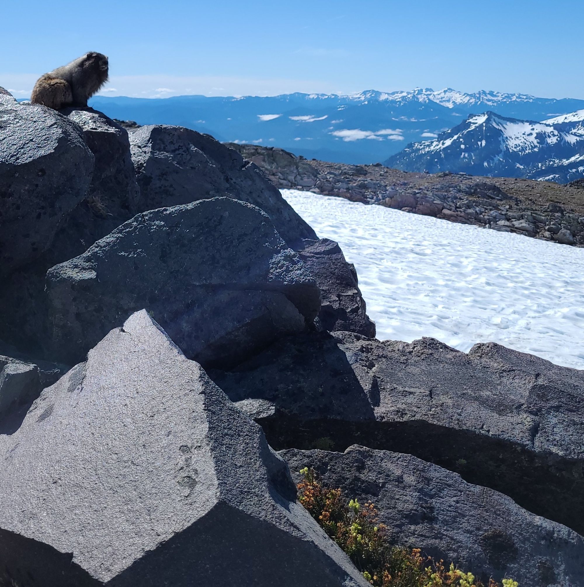
After a steep initial climb, you will find yourself trekking up a more modest incline with stone-carved staircases and stunning views of Mount Rainier and Glacier Vista. At this point in the hike, keep your eyes peeled for animal wildlife, like mountain goats and hoary marmots.
Hiking along the Nisqually Glacier brings you to the division between the trails which continue to Camp Muir or towards panorama point. We accidentally trekked a half mile along this stretch of trail before realizing our mistake and turning back along the Skyline Loop. We wished we’d had more time to explore as the steep elevation climb would’ve made for consistently incredible views along the way up.
From Panorama Point, you’ll be met with stunning views of Paradise Valley, Mount St. Helens, Mt. Adams, and, if you’re lucky enough to be there on a clear day, Mt. Hood in the distance.
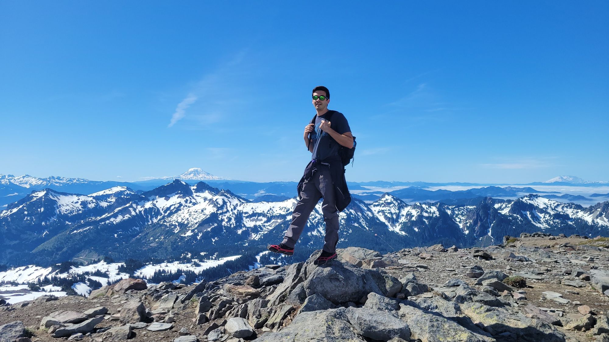
At this time of year, most of the people who were hiking along the Skyline Trail decided to turn back around and head back in the direction that we came from. We decided to continue along the loop as we had our trail map to guide us. Coming back down the southeast side of the trail, it is steeper than the gradual slopes heading up the mountain from the west side of the trail. We lost the trail more than once through the snowfields but always managed to glissade our way back onto it.
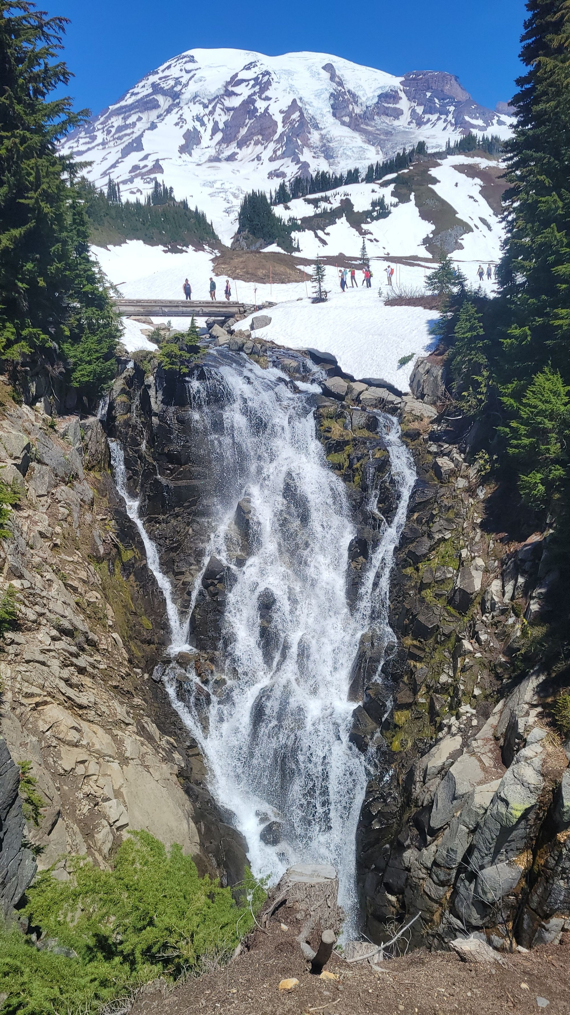
As you near the Jackson Visitors Center, you will cross the bridge to Myrtle Falls, offering the best waterfall view on the trail with a gorgeous view of Mount Rainier in the background.
We managed to hike this loop in 3 hours and 15 minutes. This trail was absolutely stunning, and honestly, our only regret was having missed the colorful wildflowers, which were right on the cusp of blooming. It’s not hard to imagine what this magnificent mountain looks like mid-summer.
This was a perfect hike for showcasing the beauty of Mount Rainier. Since we only had 1 full day to spend in the park, we were glad to have chosen this trail.
These hikes were only the beginning of our 8-day hiking journey across Washington State. We loved our hiking experiences in North Cascades and Olympic National Parks as well!
Wish List:
If we’d had more time to spend at Mount Rainier, we likely would have spent it hiking up to Camp Muir, adding an additional 2.2 miles onto the total distance hiked and a whopping 2900 additional feet of elevation gain. This is also a common starting point for mountaineering to the Summit. With extra time, we would’ve loved to have done the three-day climb via Camp Muir, Ingraham Glacier & Disappointment Cleaver. If anything, hiking the Skyline trail made us excited to research and prepare for future mountaineering expeditions.
With only one day in the park, we decided to explore only the Ohanepecosh and Paradise regions on the southern side of the mountain. This is also the most popular area of the park. However, we missed out on the beauty of the Sunrise area trails in the northeastern region of the park, which has considerably fewer people and is appropriately named for its beautiful sunrise views over the surrounding North Cascades.