Top 5 Favorite Hikes
As we continue hiking around the world, we will update this list :)
Here are our current all-time favorite hikes!
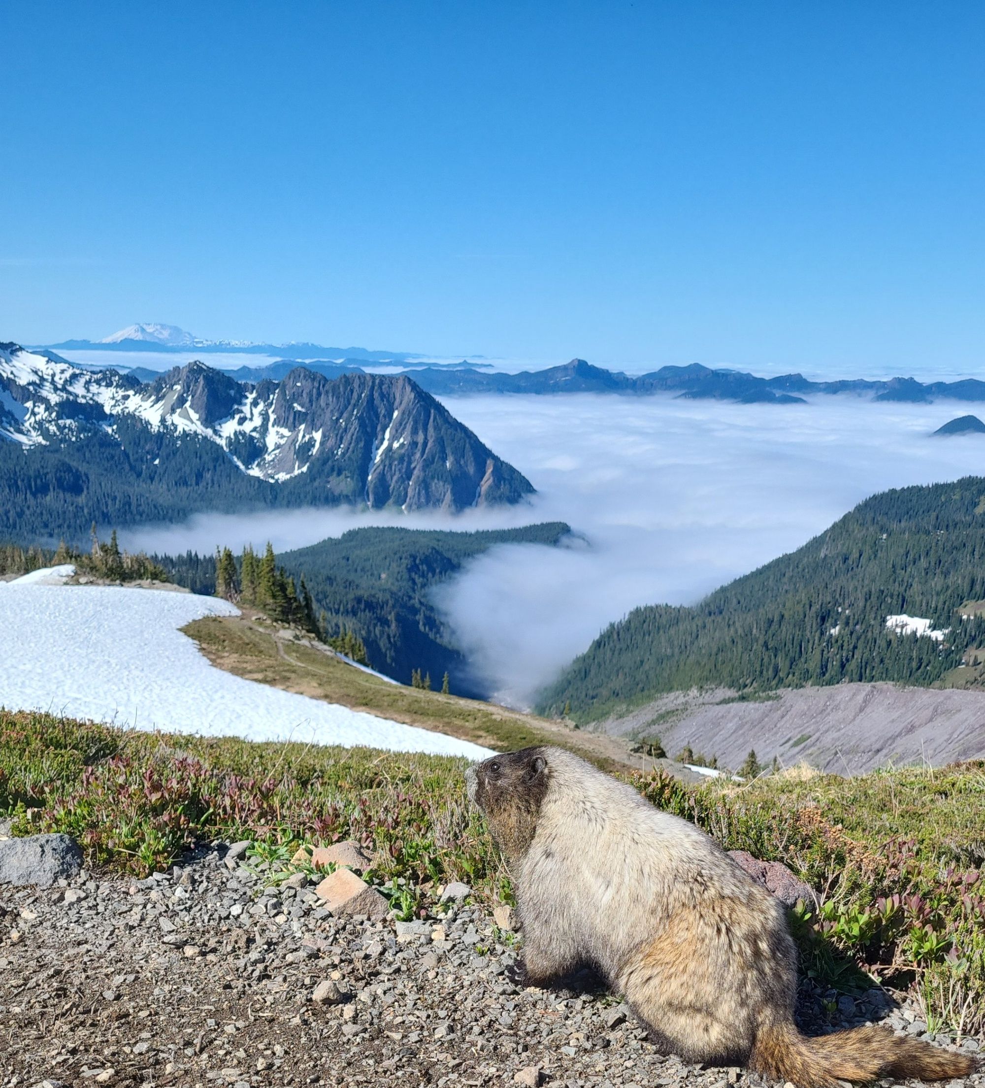
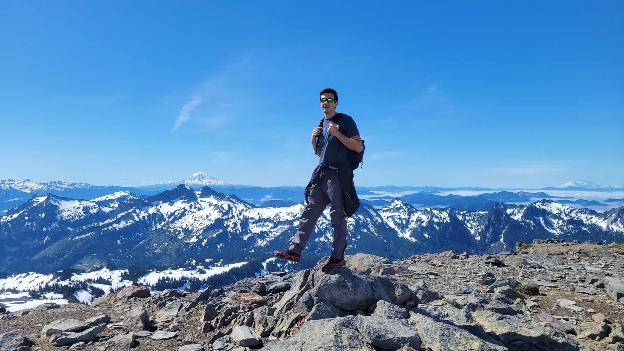
5 - Skyline Trail - Mount Rainier National Park, WA
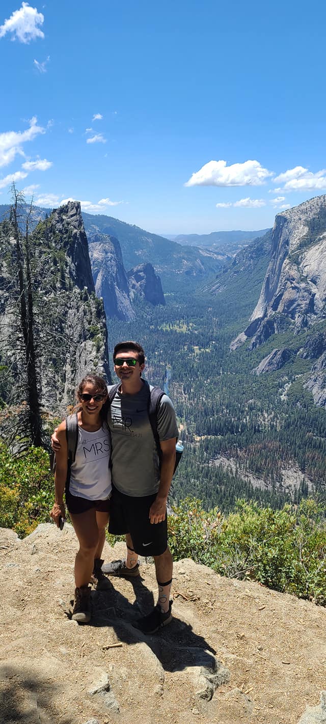
4 - Four Mile Trail to Glacier Point - Yosemite National Park, CA
3 - Hanakāpīʻai Falls via Kalalau Trail - Kauai, HI
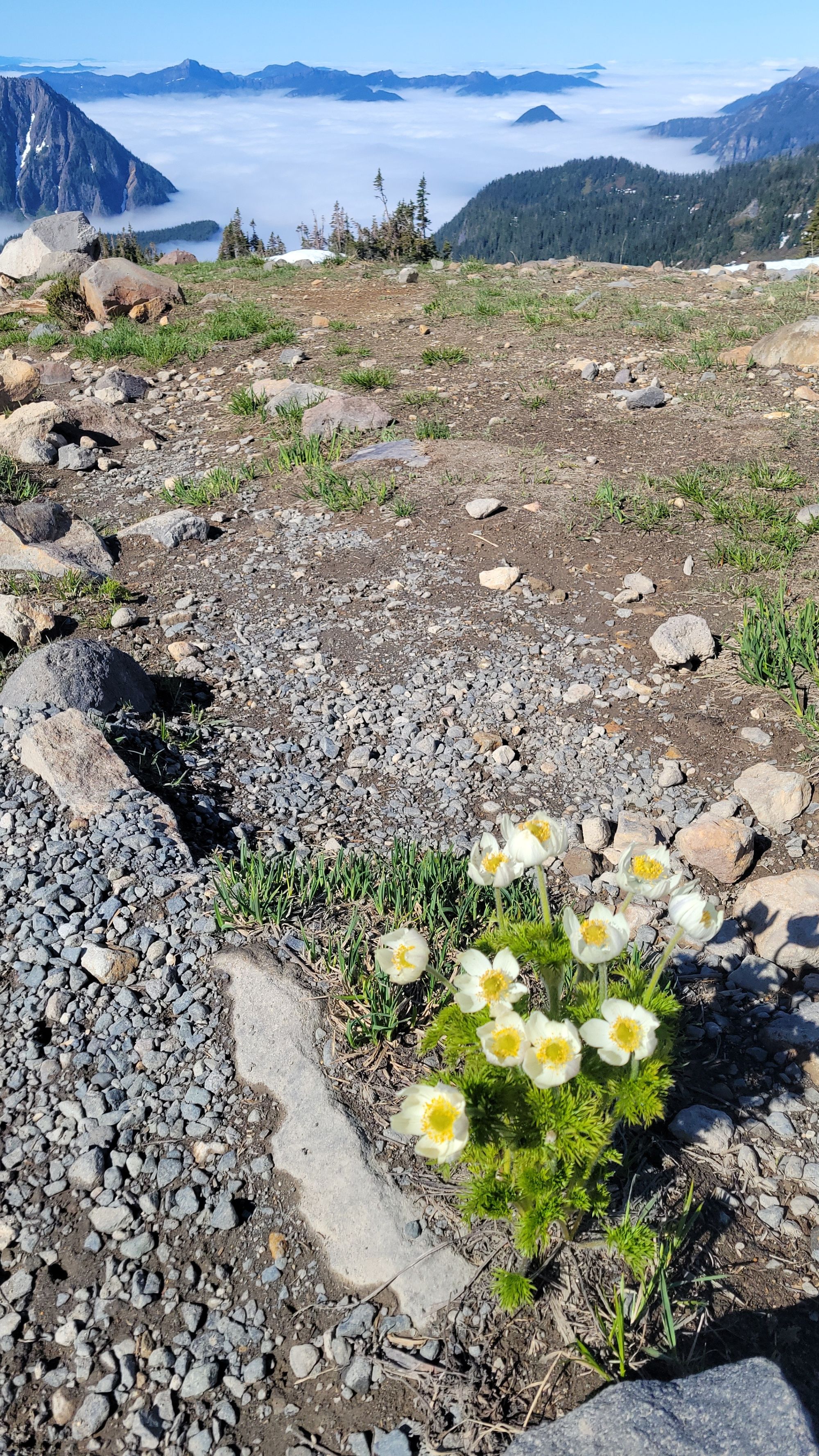
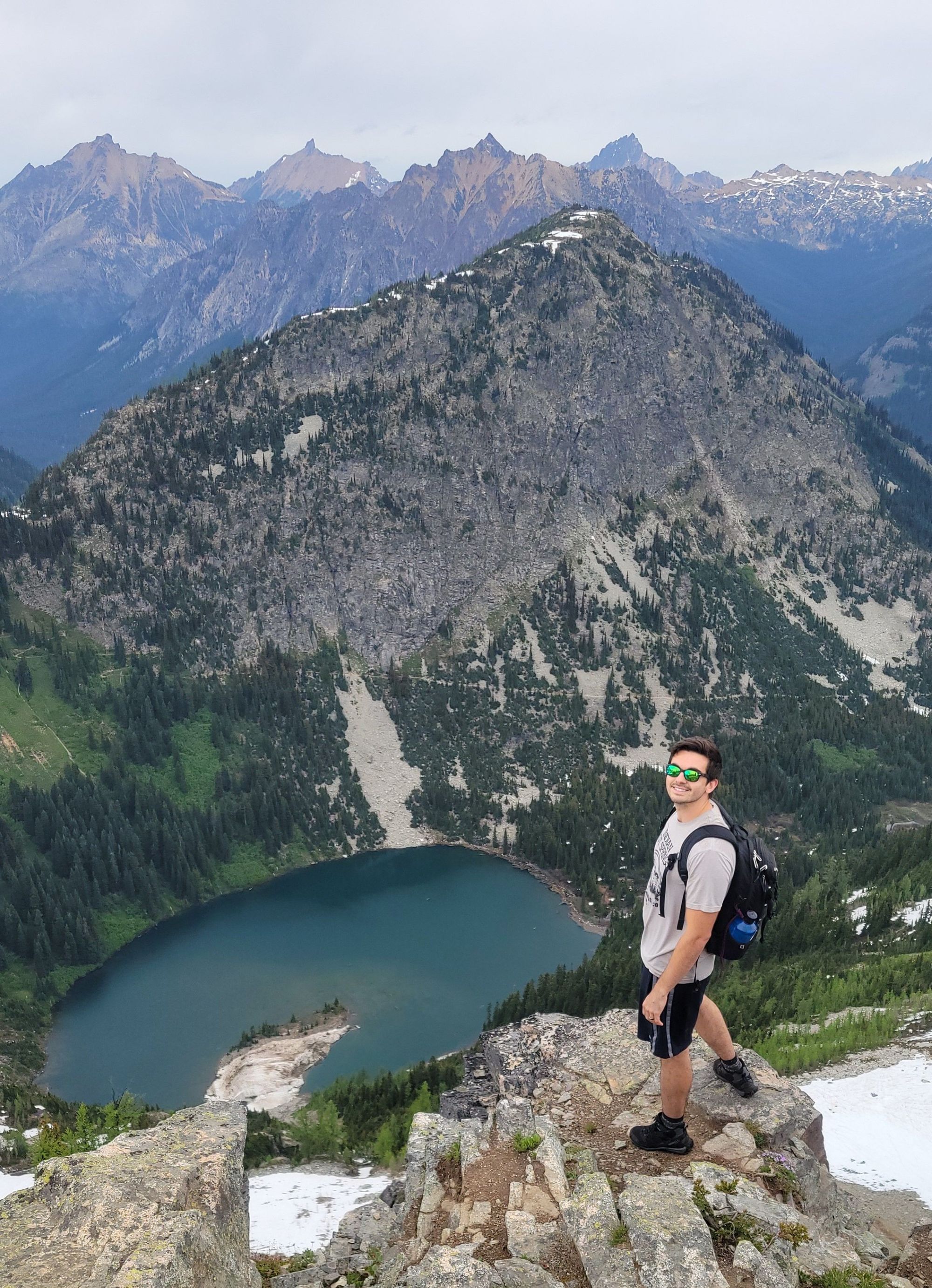
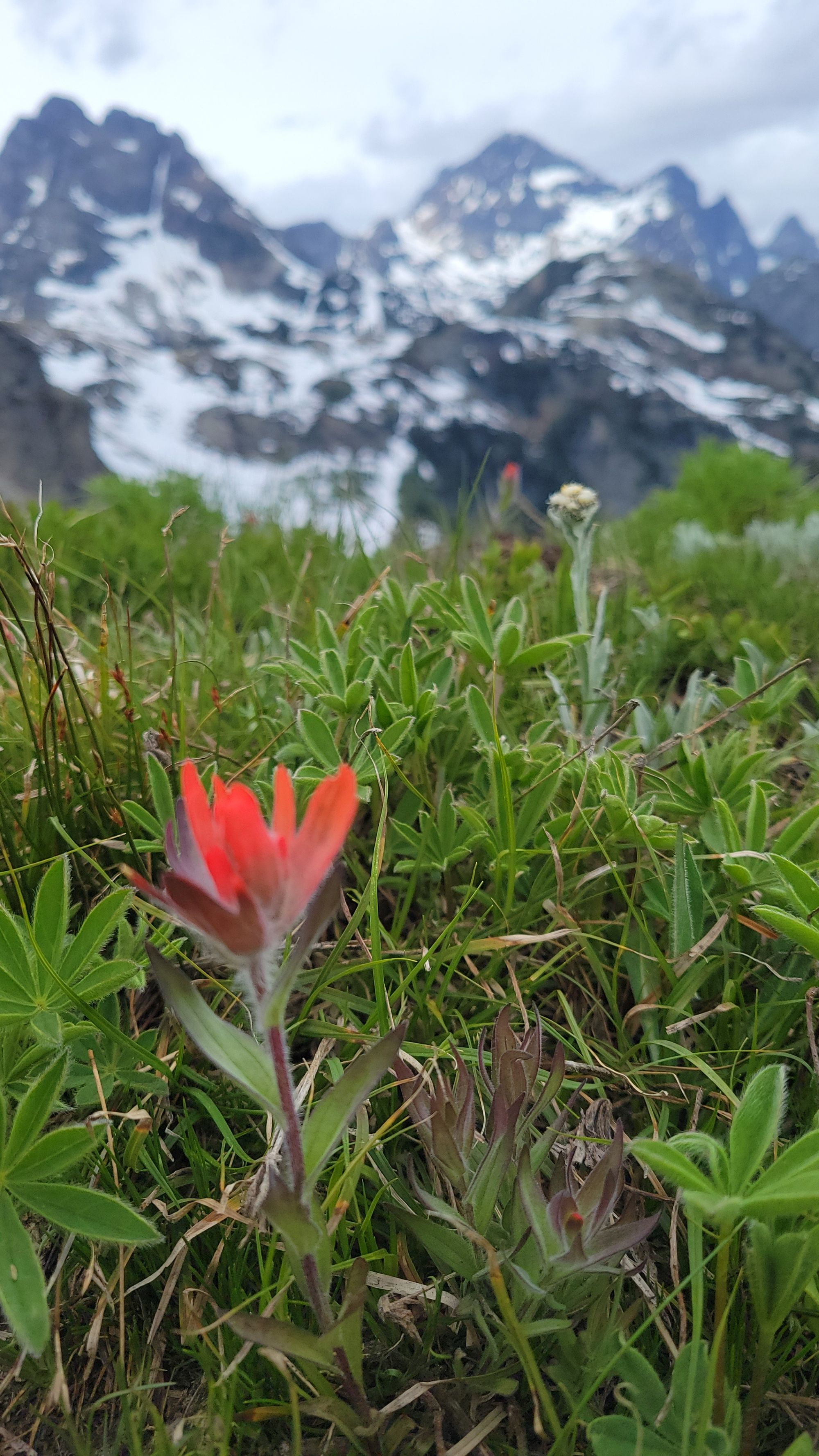
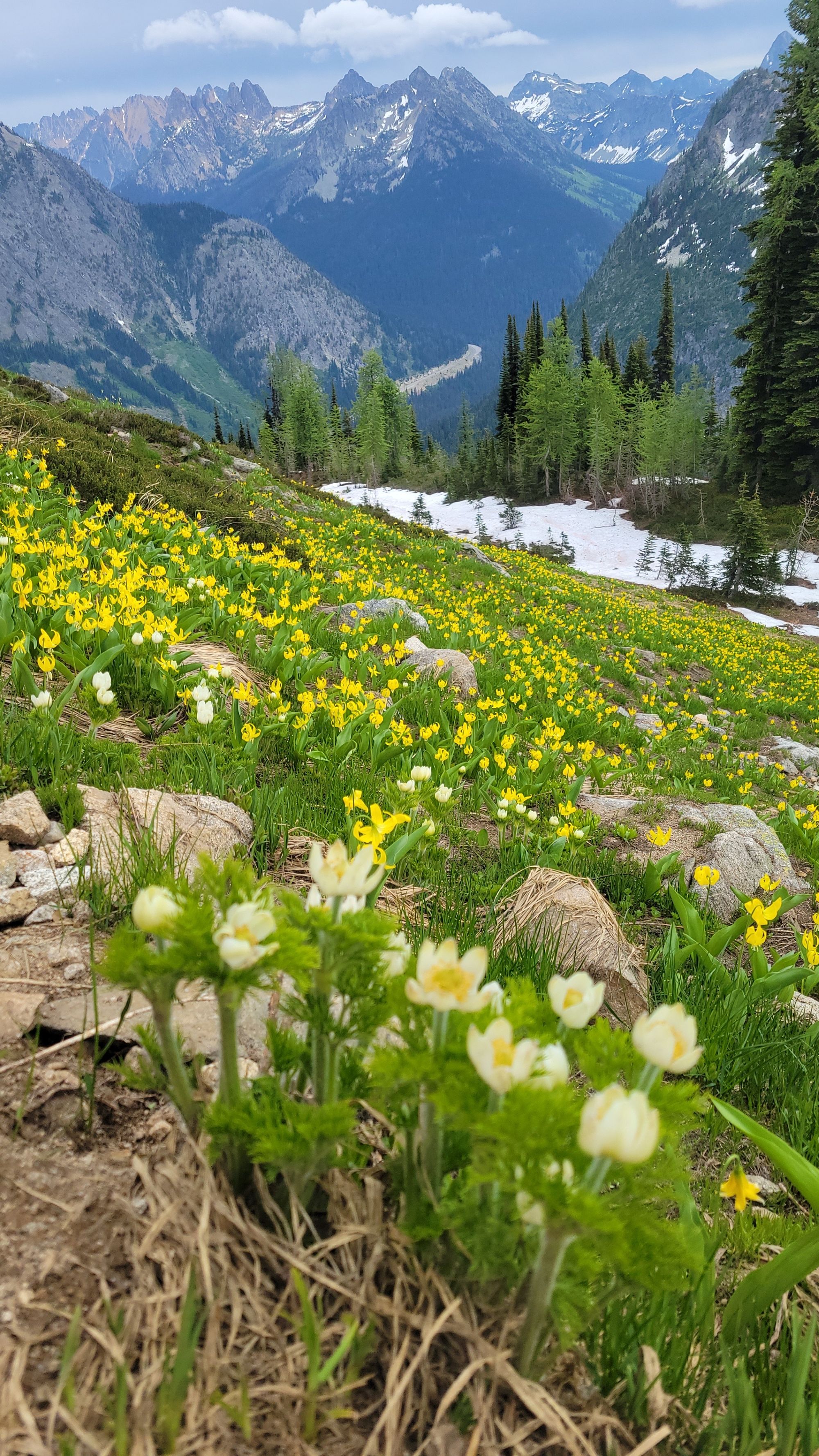
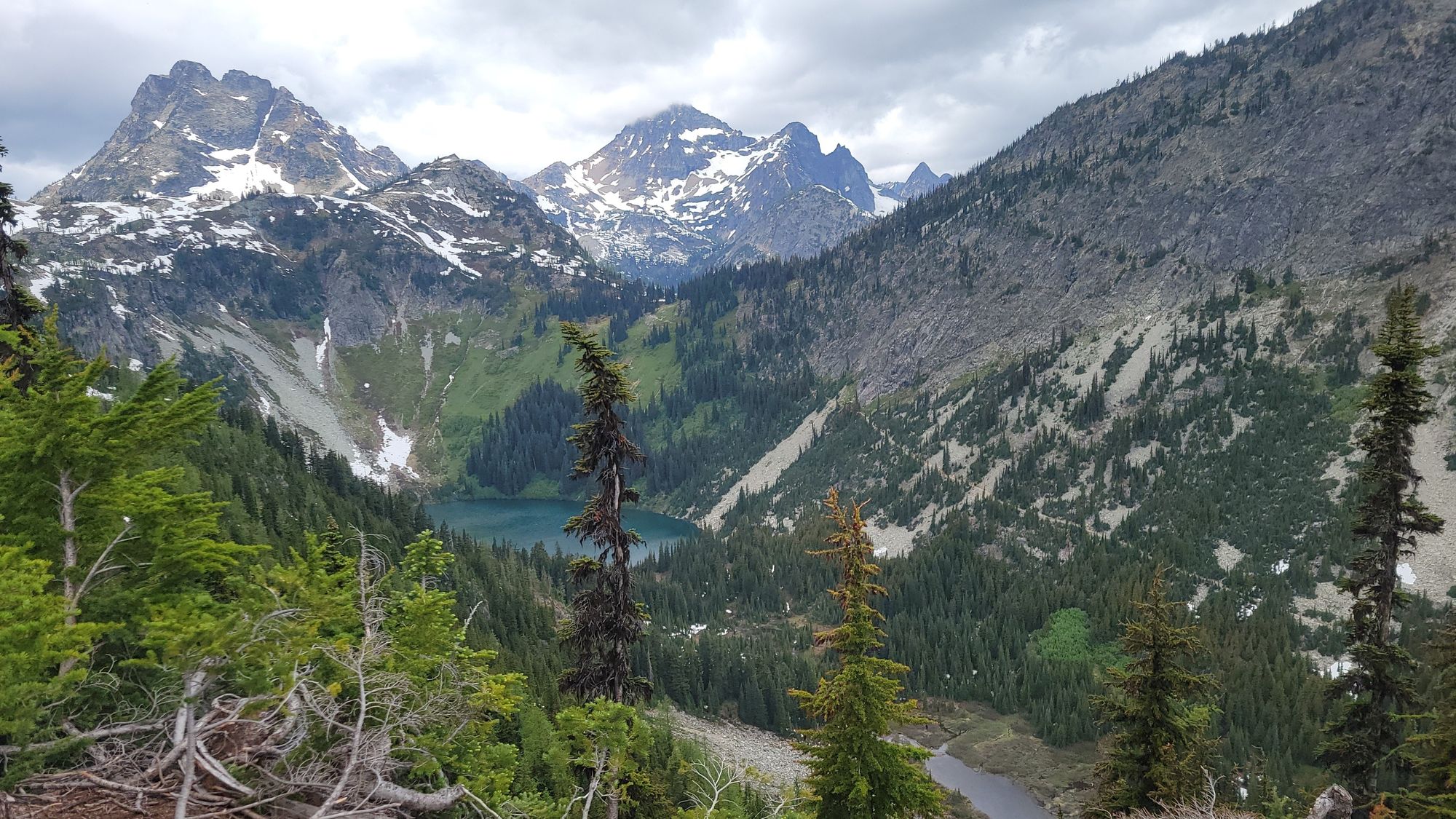
2 - Maple Pass Trail - North Cascades National Park, WA
1 - Kjeragbolten - Lysefjord, Norway
5 - Skyline Trail Loop - Mount Rainier National Park, WA
Difficulty: Moderate. Distance: 5.6 miles. Elevation gain: 1,771 ft. Time: 3-4.5 hours. Trailhead: Jackson Visitors Center in Paradise.
When we visited in mid-June, the trail was still almost entirely covered in snow, and we did manage to lose the trail in a few spots before managing to find our way back to it. Microspikes were helpful but not an absolute necessity. We decided to hike this trail clockwise, but it’s certain to inspire awe from either direction.
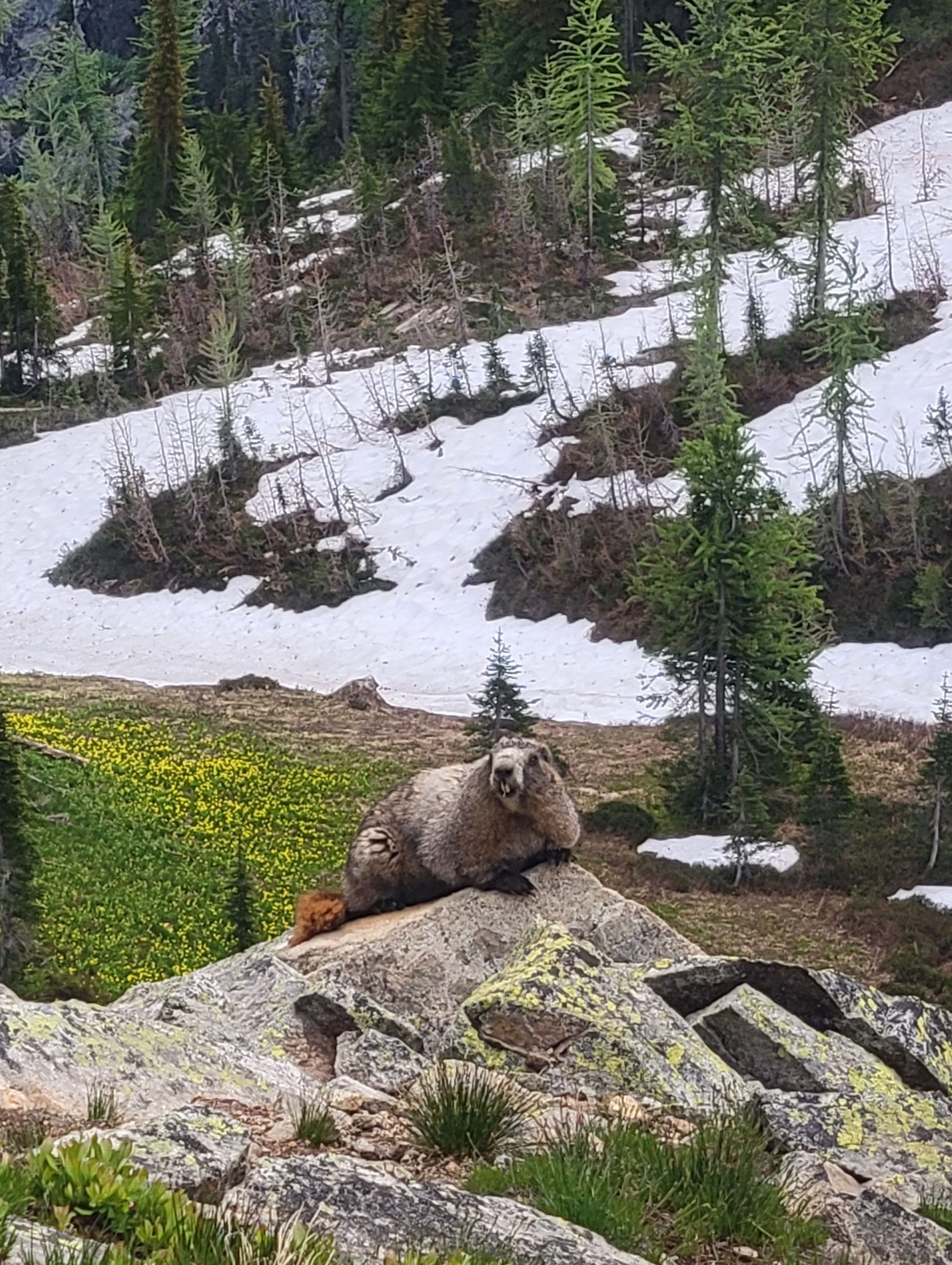
After a steep initial climb, you will find yourself trekking up a more modest incline with stone-carved staircases and stunning views of Mount Rainier and Glacier Vista. At this point in the hike, keep your eyes peeled for animal wildlife, like mountain goats and hoary marmots.
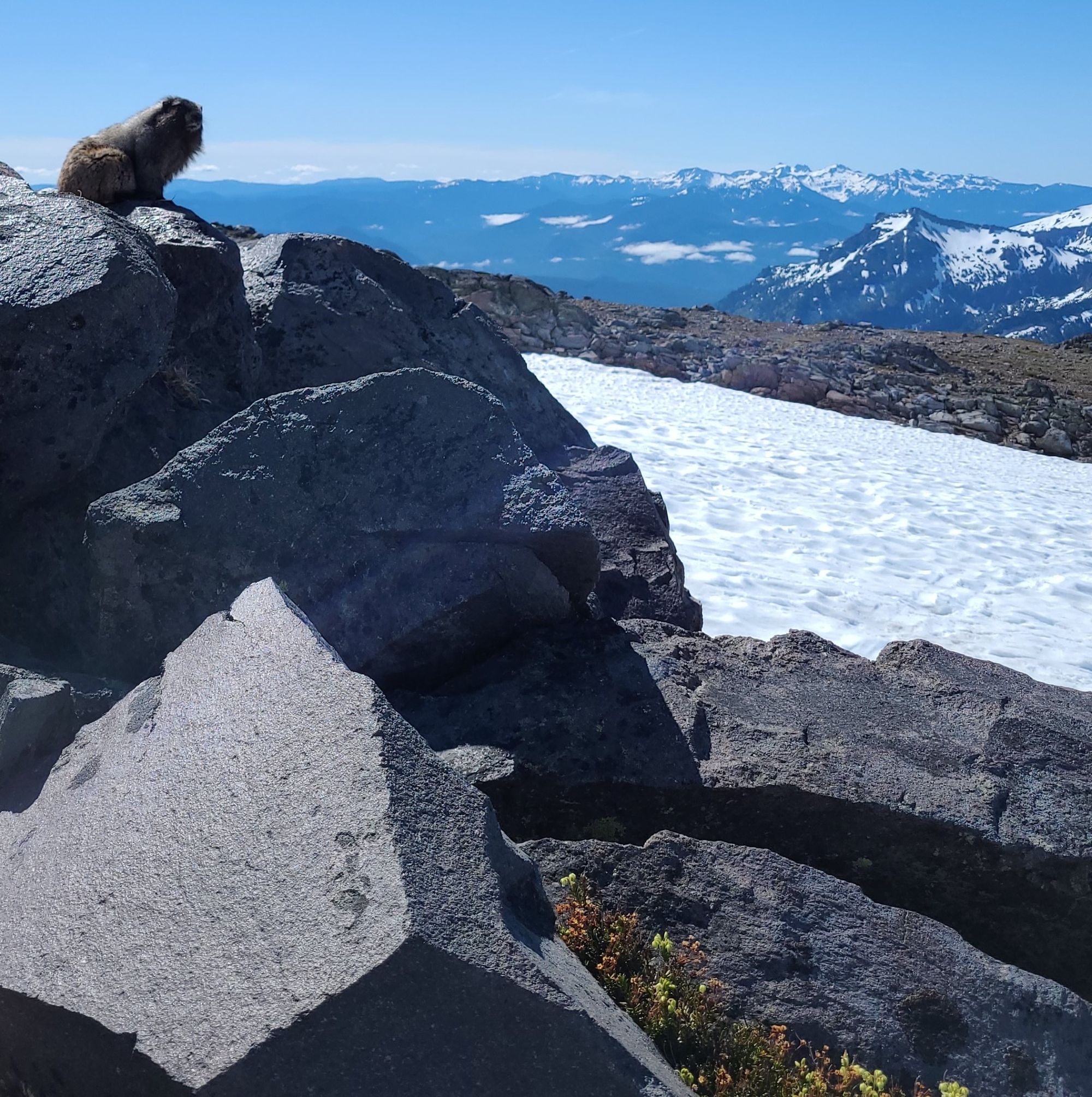
Hiking along the Nisqually Glacier brings you to the division between the trails which continue to Camp Muir or towards panorama point. We accidentally trekked a half mile along this stretch of trail before realizing our mistake and turning back along the Skyline Loop. We wished we’d had more time to explore as the steep elevation climb would’ve made for consistently incredible views along the way up.
From Panorama Point, you’ll be met with stunning views of Paradise Valley, Mount St. Helens, Mt. Adams, and, if you’re lucky enough to be there on a clear day, Mt. Hood in the distance.
At this time of year, most of the people who were hiking along the Skyline Trail decided to turn back around and head back in the direction that we came from. We decided to continue along the loop as we had our trail map to guide us. Coming back down the southeast side of the trail, it is steeper than the gradual slopes heading up the mountain from the west side of the trail. We lost the trail more than once through the snowfields but always managed to glissade our way back onto it.
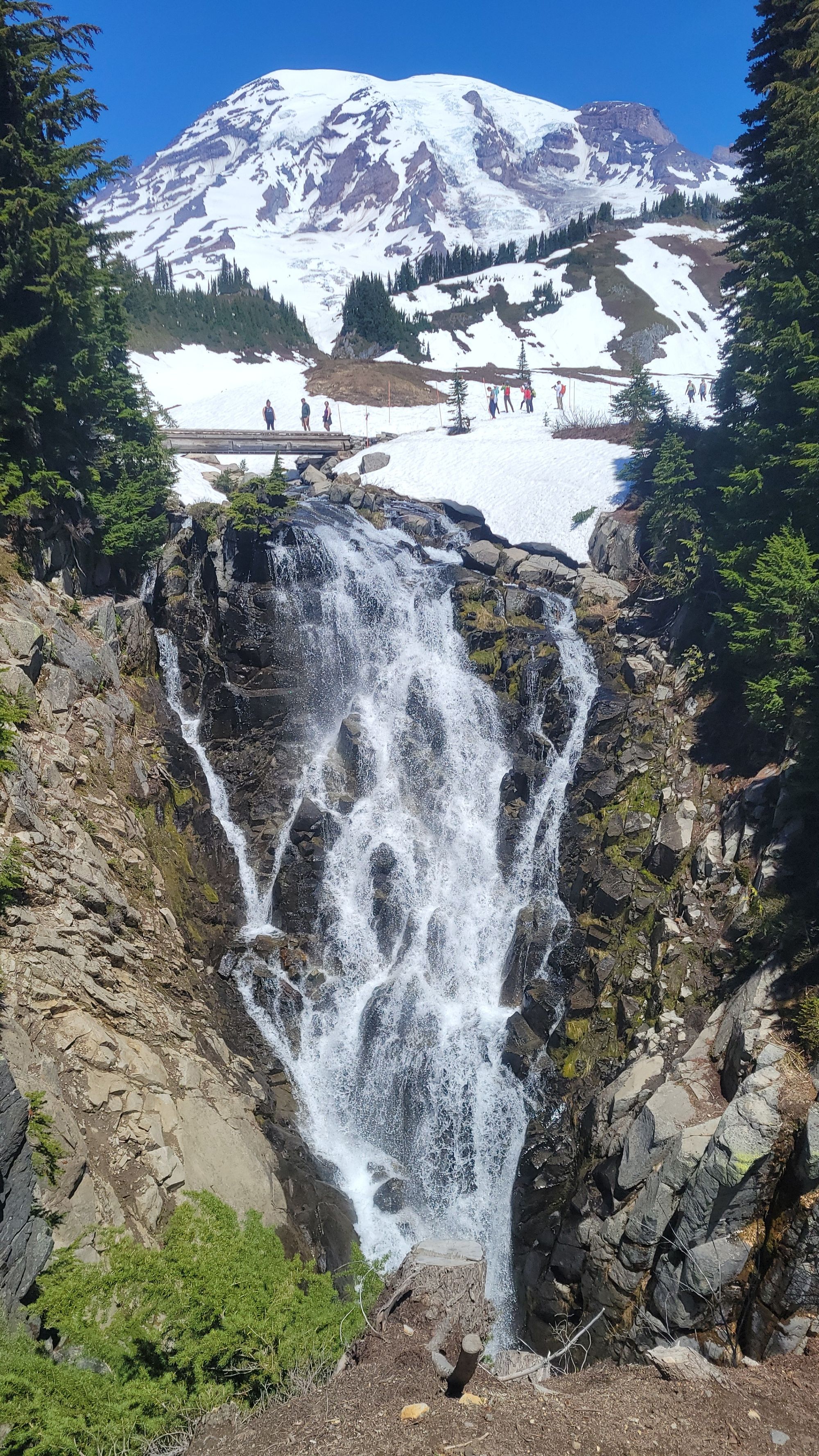
As you near the Jackson Visitors Center, you will cross the bridge to Myrtle Falls, offering the best waterfall view on the trail with a gorgeous view of Mount Rainier in the background.
We managed to hike this loop in 3 hours and 15 minutes. This trail was absolutely stunning, and honestly, our only regret was having missed the colorful wildflowers, which were right on the cusp of blooming. It’s not hard to imagine what this magnificent mountain looks like mid-summer.
This was a perfect hike for showcasing the beauty of Mount Rainier. Since we only had 1 full day to spend in the park, we were glad to have chosen this trail.
These hikes were only the beginning of our 8-day hiking journey across Washington State. We loved our hiking experiences in North Cascades and Olympic National Parks as well!
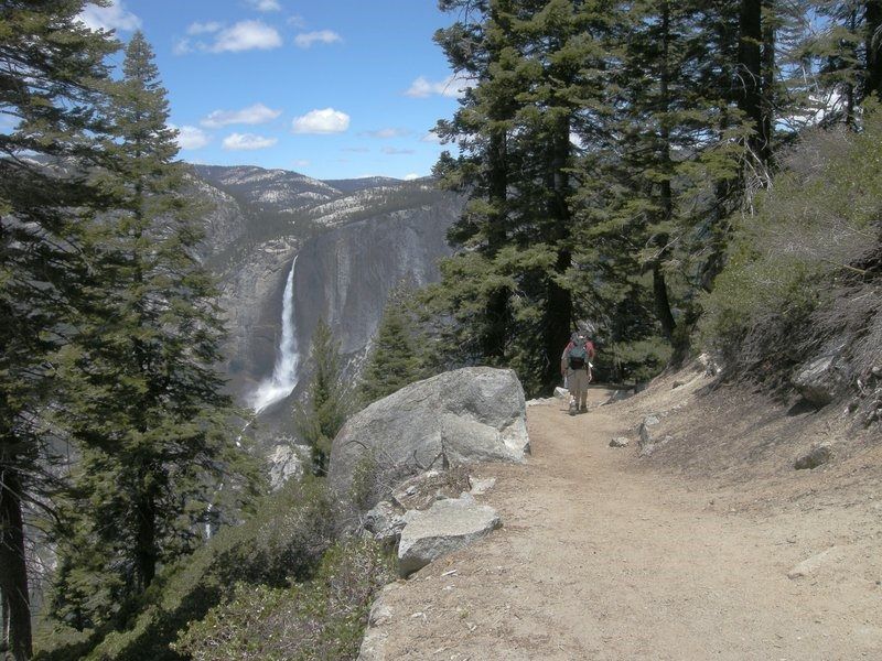
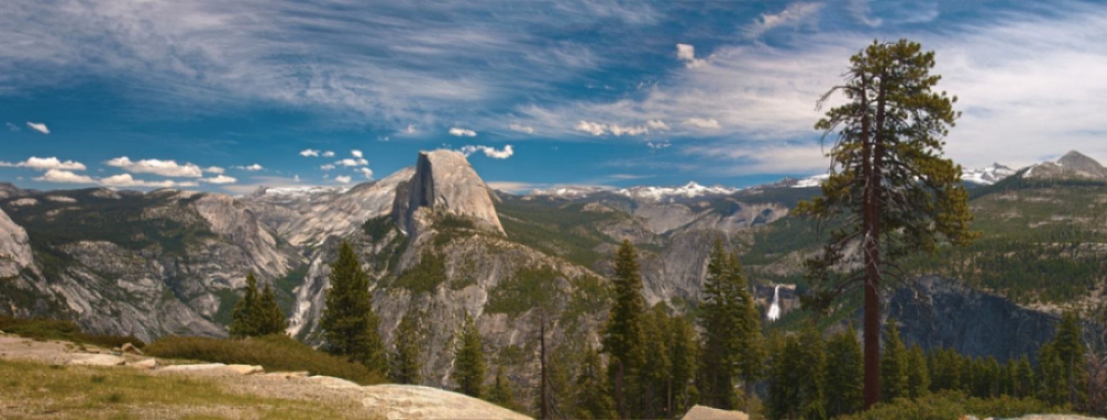
4 - Four Mile Trail to Glacier Point - Yosemite National Park, CA
Difficulty: Hard. Distance: 4.8 miles (one-way). Elevation gain: 3,200 ft. Time: 3-4 hours (one-way). Trailhead: Four Mile Trailhead.
Half of our wedding party hiked with us up the Four Mile Trail to Glacier Point. The trail switchbacks 3,200 ft up from Yosemite Valley with astonishing views of Half Dome, North Dome, El Capitan, Cathedral Rocks, the Royal Arches, Tenaya Canyon, and Yosemite Falls. It's up on our list of all-time favorite hikes because of its consistently incredible views the entire way up!
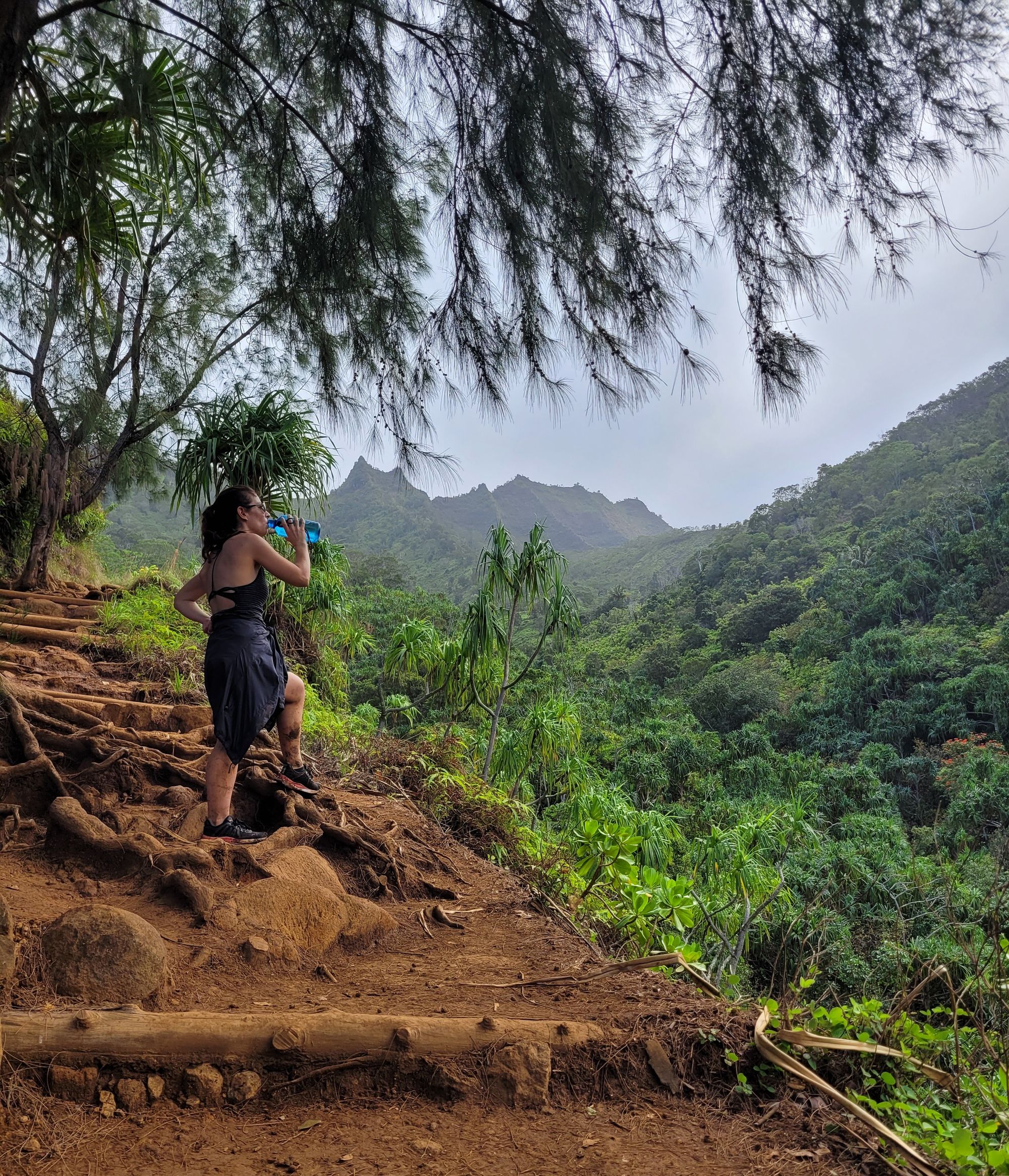
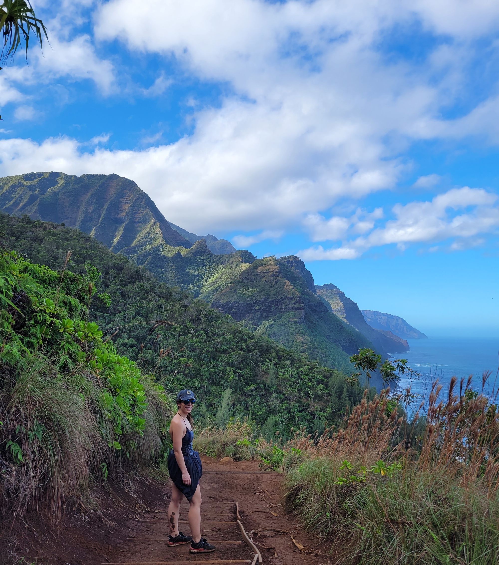
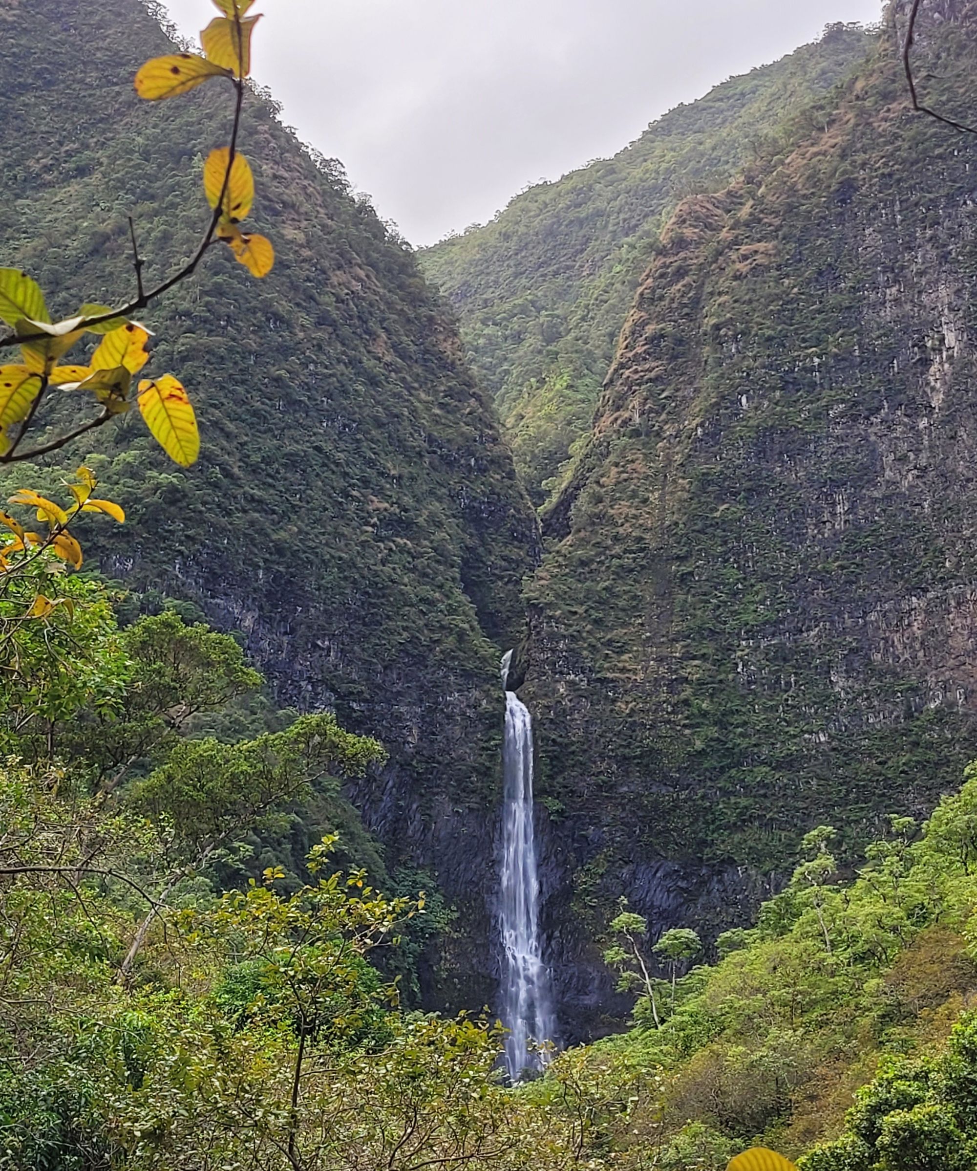
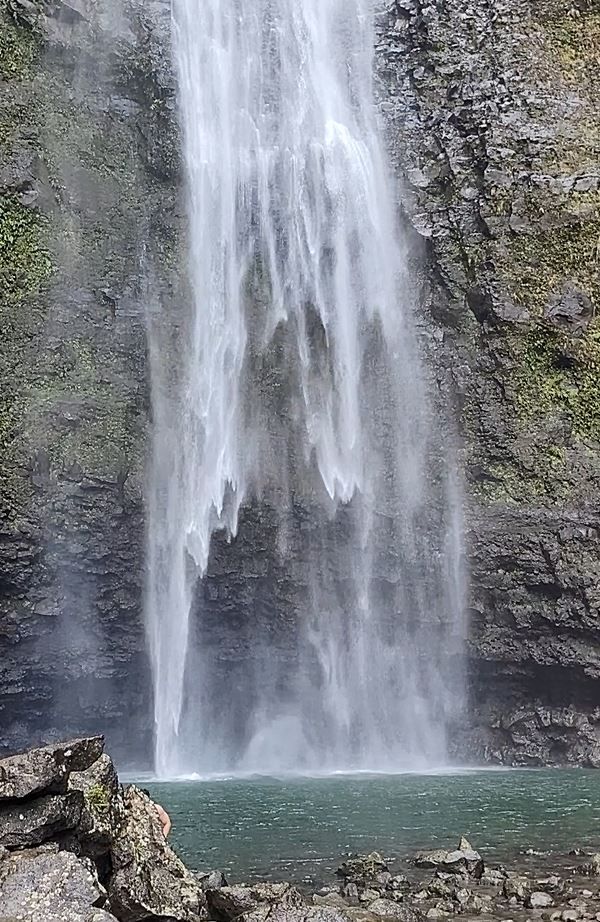
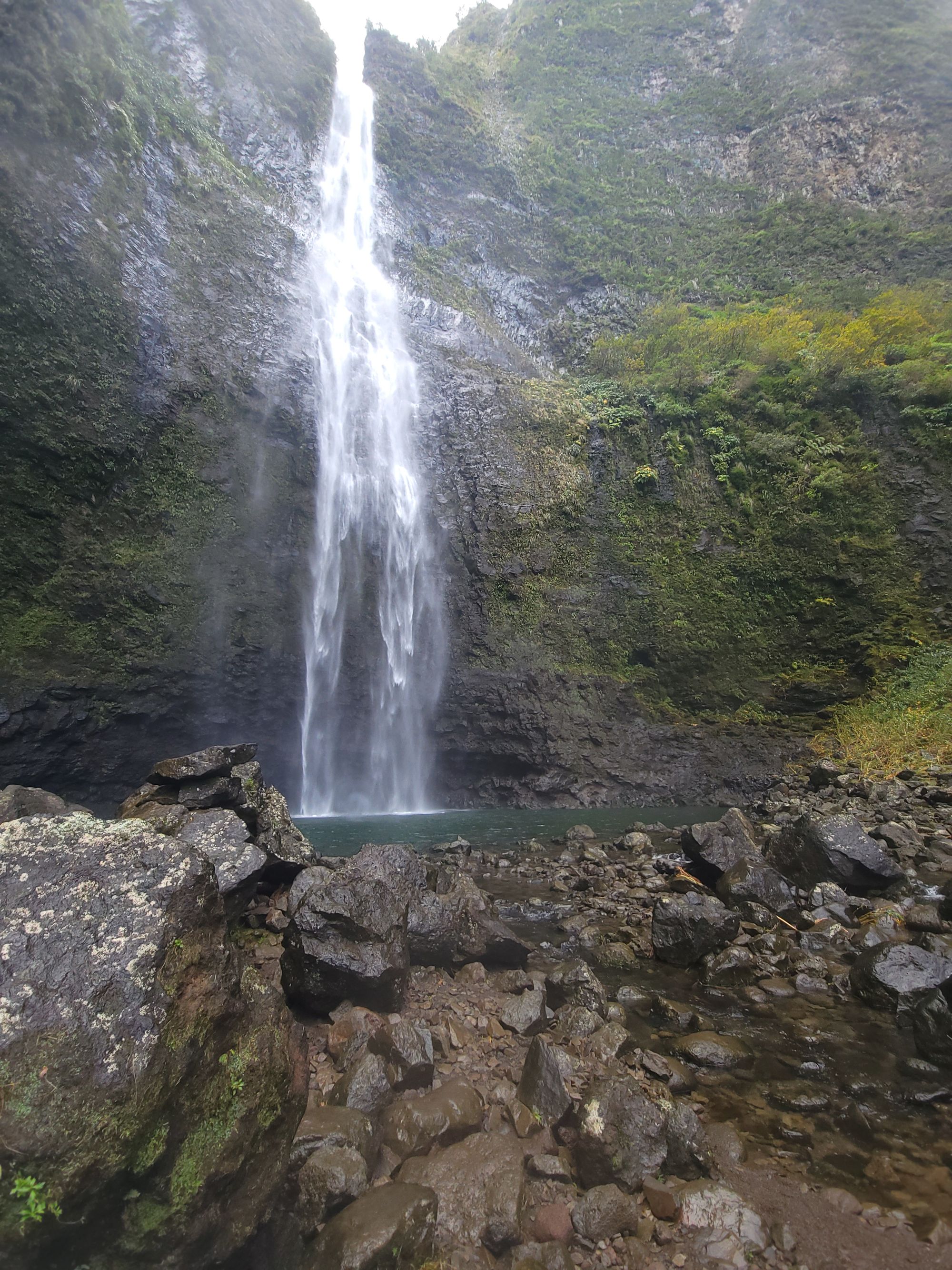
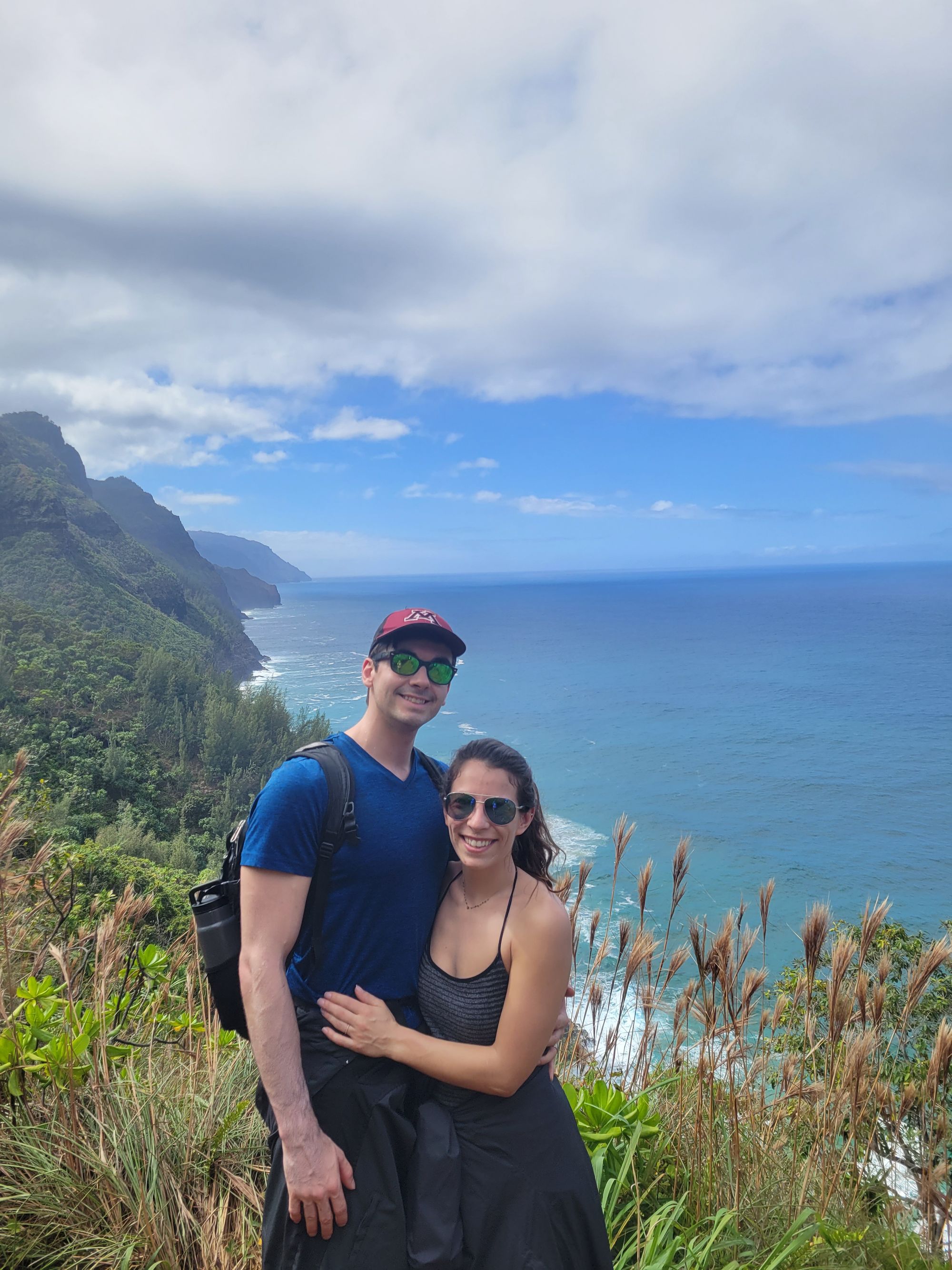
3 - Hanakāpīʻai Falls via Kalalau Trail - Kauai, HI
Difficulty: Hard. Distance: 7.7 miles. Elevation gain: 2,480 ft. Time: 5 hrs. Trailhead:
This hike exceeded all of our expectations- the Na Pali coast is truly a paradise. If you only have time for one hike while you're in Kauai, this is the one! It's decently strenuous, with multiple stream crossings and lots of up & downhills, which would be difficult if the trail were wet and muddy.
Located on the north shore of the island in the Na Pali Coast State Wilderness Park, reservations are required and must be purchased ahead of time (https://gohaena.com/). Permits are also required to hike and camp on the Kalalau Trail but are not for those hiking to Hanakāpīʻai Beach and then continuing on the Hanakāpīʻai Falls Trail.
We made an early reservation time to shuttle into the park, which ended up being an experience of its own with the driver giving an impromptu lesson in Hawaiian language and culture!
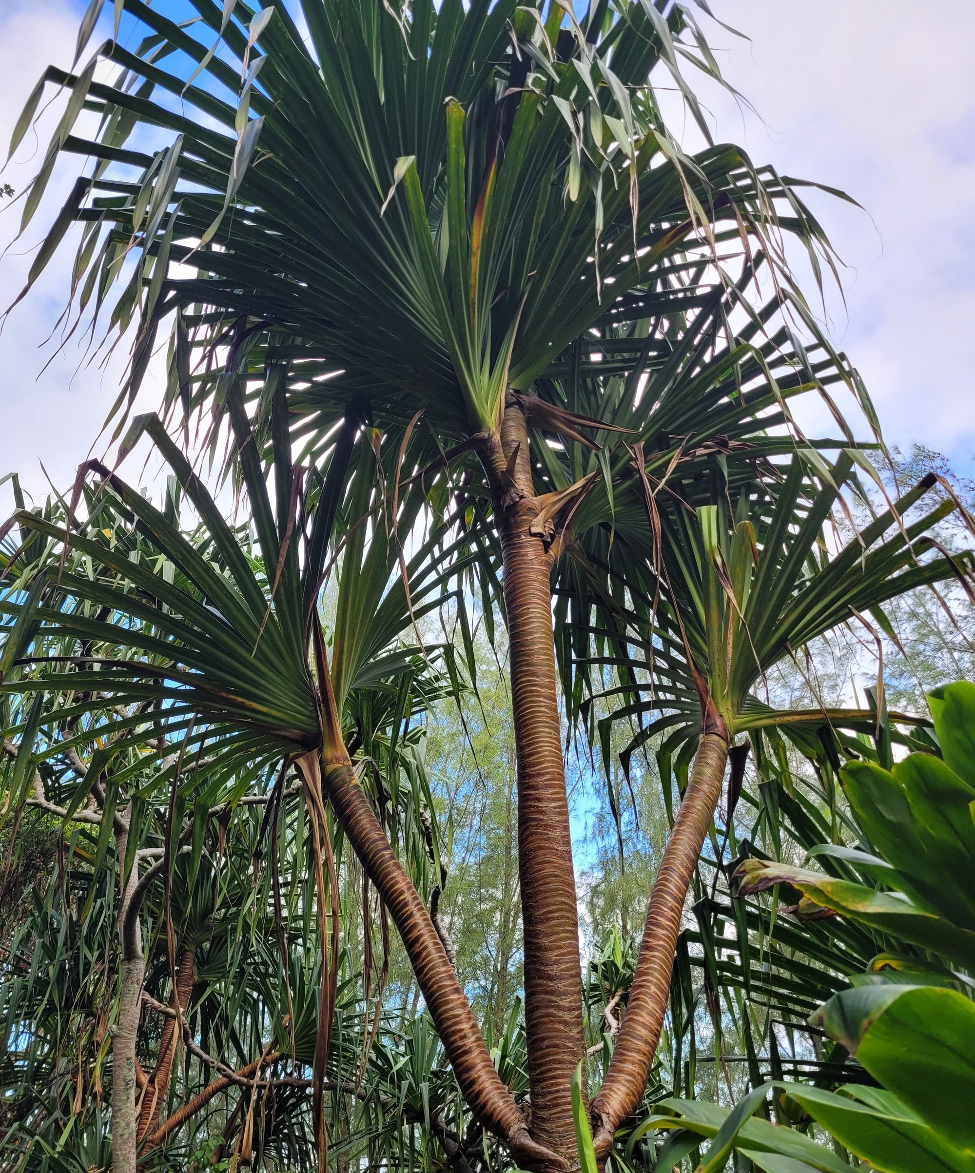
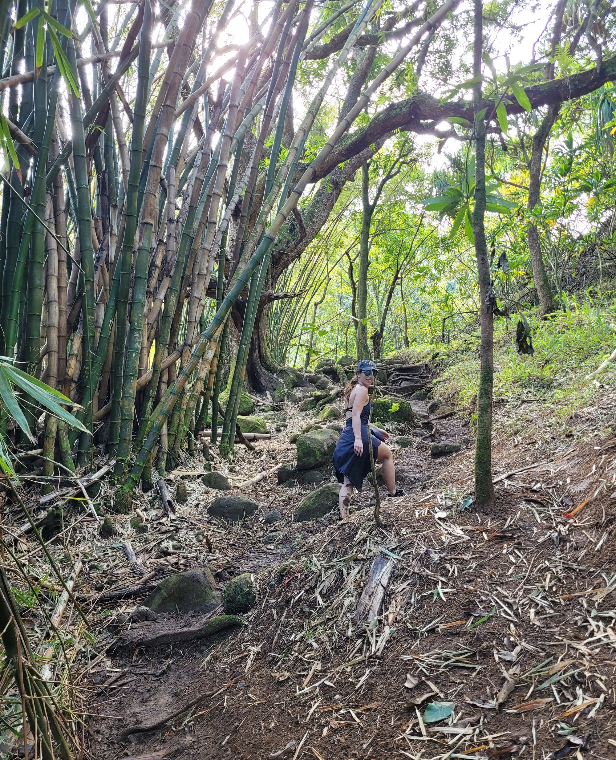
The hike starts at Ke'e Beach and traverses along the Na Pali Coast Trail for 2 miles. There is a stream crossing at the outlet into the ocean at Hanakāpīʻai Beach, which is a beautiful destination of its own! After turning onto the Hanakāpīʻai Falls Trail, there are multiple crossings over the Hanakāpīʻai stream, which make the trail less defined but still pretty easy to follow. There are many scattered patches of bamboo forest and a rock scramble at the end to bring you to the pinnacle of the hike. As we approached the falls, we could feel a sprinkling mist coming from the ~300ft waterfall. Swimming out through the cold water and feeling the weight of the falls was an unforgettable experience!
This hike took us just over 4 hours to complete, with time spent luxuriating in the falls.
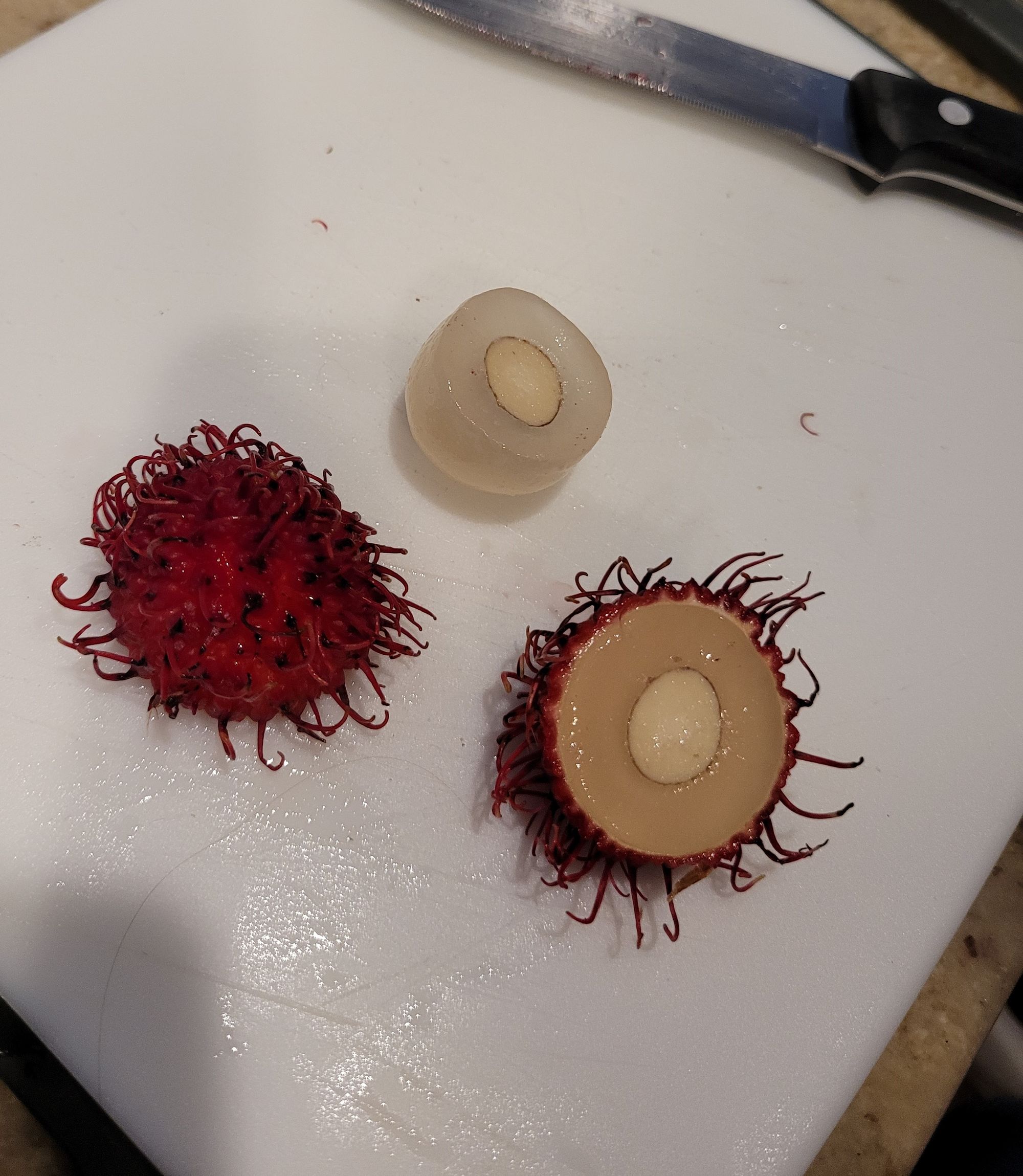
After the hike, we noticed a farmers' market happening across the street from the shuttle parking lot. We ate scrumptious Rambutan for the first time, yum!
2 - Maple Pass Trail - North Cascades National Park, WA
Difficulty: Challenging. Distance: 6.5 miles. Elevation gain: 2,162 ft. Time: 3-4. hours. Trailhead: Rainy Pass picnic area.
We saw the most incredible panoramic views at the top of Heather-Maple Pass- snow capped mountain peaks, jewel-colored alpine lakes, and wildflower buds as far as the eye can see. We were even treated to a marmot sighting! We did not have microspikes or hiking poles. We both felt that although they may have been helpful, they were not necessary. We hiked this loop counterclockwise and took the additional detour to Lake Ann. Later in the summer, this is undoubtedly a worthy side-quest. However, with large sections of the trail flooded out from recent snow melt, we felt that the views of Lake Ann were more beautiful from above. We hiked this 6.5 mile (plus an additional 1.2 miles to see Lake Ann) in 4 hours and 20 minutes.
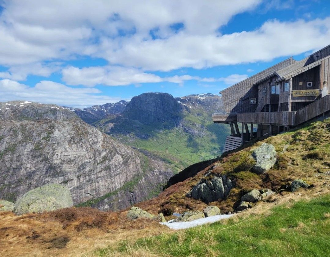
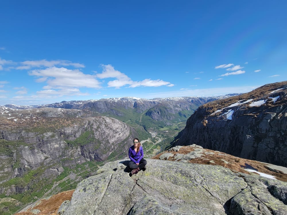
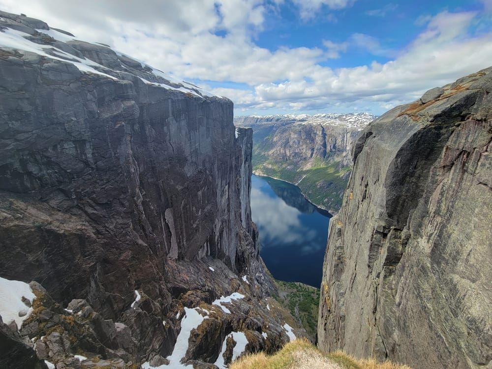
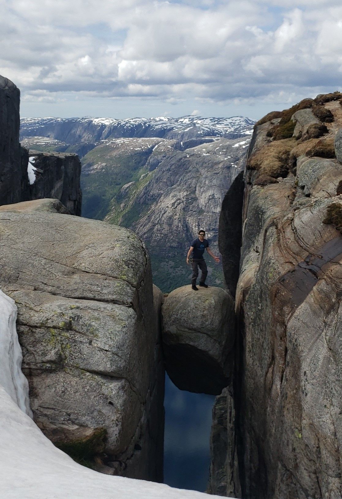
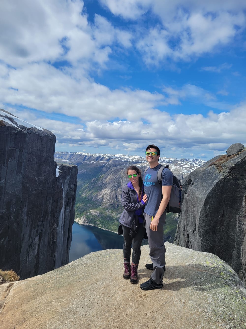
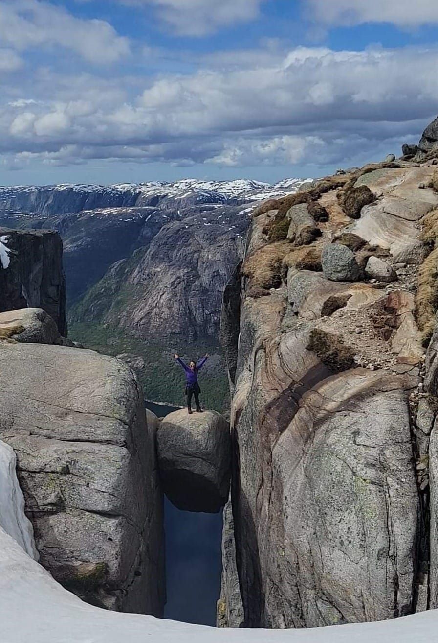
1 - Kjeragbolten - Lysefjord, Norway
Difficulty: Challenging. Distance: 5.7 miles. Elevation gain: 1,912 ft. Time: 4 hrs. Trailhead: Øygardstøl.
Our All-time Favorite Hike!!
1,084 meters above sea level, Kjerag is the highest peak in the Lysefjord. This hike was the main source of motivation that pulled us to Norway and it turned out to be the most challenging and rewarding hike we had ever done.
The hike had rope-assisted climbs, 2600ft elevation gain, one-of-a-kind streams and ponds forming from melted snow, & the opportunity to conquer your fear of heights by stepping out onto the Kjeragbolten! The adventure back down the mountain was also special, with large stretches where we could glissade back down.
This is our all-time favorite hike we have ever done, largely due to the consistently incredible views that are offered for the entire hike.